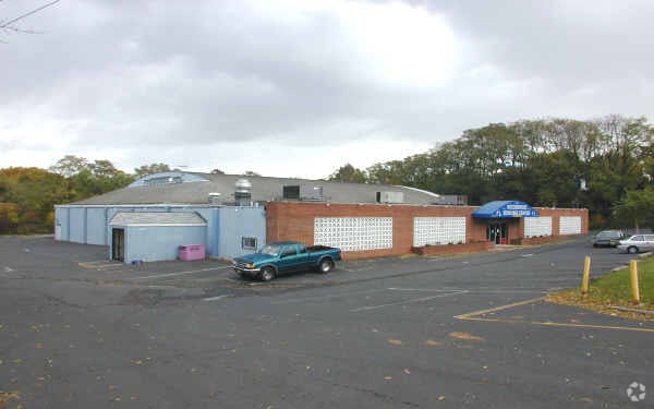
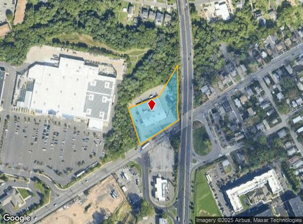
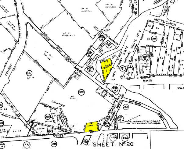
Property Record
346 Main St, Woodbridge, NJ 07095
NEARBY LISTINGS FOR SALE OR LEASE
Property Detail
346 Main St
New York-Jersey City-White Plains, NY-NJ
271 X 206 IRR
25-00288-01-00002
Middlesex
Bowlingalley
New Jersey
X
2
34023C0066F
1.28 AC
2024
North Edison/Woodbridge
2025
Northern New Jersey
003002
DEMOGRAPHICS near 346 Main St
1 Mile
3 Mile
5 Mile
2024 Total Population
16,054
143,346
338,026
2029 Population
16,064
141,514
333,517
Pop Growth 2024-2029
+ 0.06%
(1.28%)
(1.33%)
Average Age
39
39
40
2024 Total Households
6,087
49,726
117,924
HH Growth 2024-2029
(0.16%)
(1.27%)
(1.37%)
Median Household Inc
$93,250
$86,510
$96,590
Avg Household Size
2.50
2.80
2.80
2024 Avg HH Vehicles
2.00
2.00
2.00
Median Home Value
$331,150
$347,380
$417,765
Median Year Built
1972
1961
1967
Nearby Places
Map Layers
Map Styles
 Street
 Aerial
- Restaurants
- Banks
- Shops
- Fitness
- Groceries
PUBLIC TRANSPORTATION
COMMUTER RAIL
Woodbridge (North Jersey Coast Line - NJ Transit Commuter Rail (NJ Transit))
DRIVE
WALK
Distance
Woodbridge (North Jersey Coast Line - NJ Transit Commuter Rail (NJ Transit))
3 min
19 min
1.0 mi
Avenel (North Jersey Coast Line - NJ Transit Commuter Rail (NJ Transit))
DRIVE
WALK
Distance
Avenel (North Jersey Coast Line - NJ Transit Commuter Rail (NJ Transit))
5 min
3.1 mi
AIRPORT
Newark Liberty International
DRIVE
WALK
Distance
Newark Liberty International
26 min
16.2 mi
LaGuardia
DRIVE
WALK
Distance
LaGuardia
57 min
36.4 mi
John F Kennedy International
DRIVE
WALK
Distance
John F Kennedy International
57 min
39.3 mi
Freight Ports
New York Container Terminal
DRIVE
WALK
Distance
New York Container Terminal
19 min
12.0 mi
Nearby Properties
Address
Land Use
TOTAL SIZE
Lot Size
Zoning
Address
Land Use
TOTAL SIZE
Lot Size
Zoning
65.84 AC
PB
Address
Land Use
TOTAL SIZE
Lot Size
Zoning
37.32 AC
S-3B
Address
Land Use
TOTAL SIZE
Lot Size
Zoning
Address
Land Use
TOTAL SIZE
Lot Size
Zoning
11.63 AC
S-3D
Address
Land Use
TOTAL SIZE
Lot Size
Zoning
80,000 SF
23.37 AC
R50
Address
Land Use
TOTAL SIZE
Lot Size
Zoning
0.14 AC
C-4
Address
Land Use
TOTAL SIZE
Lot Size
Zoning
10.69 AC
R-MM
Address
Land Use
TOTAL SIZE
Lot Size
Zoning
15.15 AC
RMMF
Address
Land Use
TOTAL SIZE
Lot Size
Zoning
71.66 AC
M-3
Address
Land Use
TOTAL SIZE
Lot Size
Zoning
2.51 AC
H
Address
Land Use
TOTAL SIZE
Lot Size
Zoning
28.90 AC
S-3B
Address
Land Use
TOTAL SIZE
Lot Size
Zoning
52.97 AC
M-3
Address
Land Use
TOTAL SIZE
Lot Size
Zoning
64.66 AC
S-3A
Address
Land Use
TOTAL SIZE
Lot Size
Zoning
38,900 SF
10.34 AC
LI
Address
Land Use
TOTAL SIZE
Lot Size
Zoning
0.66 AC
C-4
Address
Land Use
TOTAL SIZE
Lot Size
Zoning
6.79 AC
R-50
Address
Land Use
TOTAL SIZE
Lot Size
Zoning
7.23 AC
S-2A
Address
Land Use
TOTAL SIZE
Lot Size
Zoning
27.36 AC
Address
Land Use
TOTAL SIZE
Lot Size
Zoning
191.81 AC
R75
Address
Land Use
TOTAL SIZE
Lot Size
Zoning
6,822 SF
29.22 AC
S-2C
Address
Land Use
TOTAL SIZE
Lot Size
Zoning
65.20 AC
Address
Land Use
TOTAL SIZE
Lot Size
Zoning
39.14 AC
M-3
Address
Land Use
TOTAL SIZE
Lot Size
Zoning
176.42 AC
Address
Land Use
TOTAL SIZE
Lot Size
Zoning
35.05 AC
M-3
Address
Land Use
TOTAL SIZE
Lot Size
Zoning
10,173 SF
14.04 AC
OR
Address
Land Use
TOTAL SIZE
Lot Size
Zoning
30.50 AC
Address
Land Use
TOTAL SIZE
Lot Size
Zoning
64.66 AC
S-3A
Address
Land Use
TOTAL SIZE
Lot Size
Zoning
9.72 AC
M-1
Address
Land Use
TOTAL SIZE
Lot Size
Zoning
60.44 AC
S-3A
Address
Land Use
TOTAL SIZE
Lot Size
Zoning
317 SF
11.60 AC
R-MM
The World's #1 Commercial Real Estate Marketplace
Connect with us
© 2025 CoStar Group
The information above has been obtained from sources believed reliable. While we do not doubt its accuracy we have not verified it and make no guarantee, warranty or representation about it. It is your responsibility to independently confirm its accuracy and completeness. Any projections, opinions, assumptions, or estimates used are for example only and do not represent the current or future performance of the property. The value of this transaction to you depends on tax and other factors which should be evaluated by your tax, financial, and legal advisors. You and your advisors should conduct a careful, independent investigation of the property to determine to your satisfaction the suitability of the property for your needs.